Do you want to have information on Dokdo?We are ready to provide the information you need about Dokdo.
Location

- Dongdo: latitude: 37°14' 26.8"; longitude: 131°52' 10.4"
- Seodo: latitude: 37°14' 30.6"; longitude: 131°51' 54.6"
Administrative district
1~96, Dokdo-ri Ulleung-eup, Ulleung-gun, Gyeongsangbuk-do, 40240 (101 land lots in total)
Road name addresses
-
Dongdo
(Dokdo Security Police) 55 Dokdoisabu-gil, Ulleung-eup, Ulleung-gun, Gyeongsangbuk-do
(Dokdo Lighthouse) 63, Dokdoisabu-gil, Ulleung-eup, Ulleung-gun, Gyeongsangbuk-do -
Seodo
(Residential building for the local inhabitants): 3, Dokdoanyongbok-gil, Ulleung-eup, Ulleung-gun, Gyeongsangbuk-do
Composition
Dokdo covers an area of 187,554m² in total (Dongdo: 73,297m²; Seodo: 88,740m²; other adjacent islets: 25,517m²).
Dokdo is composed of Dongdo and Seodo and 89 adjacent islets. The shortest distance between Dongdo and Seodo is 151 meters at sea level when the tide is out.
-
Dongdo
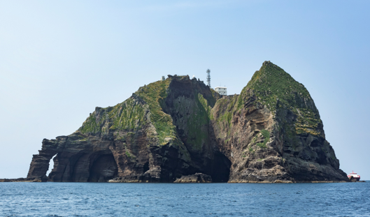
Dongo's highest point is Usanbong Peak (98.6m), and its circumference is 2.8 km. It houses a jetty, a building for the security police, a heliport, and manned lighthouse among other facilities. -
Seodo
Seodo's highest point is Daehanbong Peak (168.5 m), and its circumference is 2.6 km. Currently Residents’ living quarters, drinking facilities and hiking trail are in use.

Natural Environment
Climate (in Dokdo and Ulleungdo)
-
Temperature
It has an oceanic climate. Its average annual temperature is 12.4°C. The average temperature in January and August is 1°C and 23°C respectively.
It is windy throughout the year and its average wind speed is 4.3 m/s. The wind is mostly southwesterly in summer and northeasterly in winter. -
Precipitation
It is cloudy more than 160 days per year and often foggy.
There are an average 150 days of rain per year on the island, with an average annual precipitation of around 1,240mm.
-
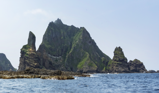 Daehanbong Peak and Neopdeok Rock on Seodo
 -
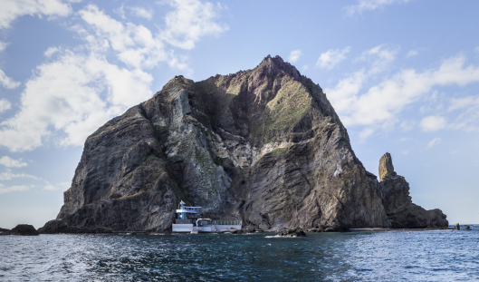
 The lighthouse and the building of the Dokdo Security Police on Dongdo
 -
 Residence of local inhabitants and Tanggeonbong Peak on Seodo
 -
 Hanbando Rock and Dongnimmun Rock on Dongdo